Have you ever thought about subway maps? Most subway systems around the world use the schematic developed by Harry Beck. Beck’s maps conforms the subway lines to a geographically distorted model such that the angles of the lines are limited to 45 and 90 degrees. Additionally, for ease of readability, the stops are depicted with a similar distance, despite the fact that the stations at central locations are typically much closer than those in the outskirts of the city.

Geographically Accurate London Tube Map – Image credit: kottke.org

London Tube Map in the Beck system – Image credit: bbc.co.uk
By comparing these two maps we can get a sense of the distortion impinged upon by the Beck’s restrictions. NYU professor, Zhan Guo has shown in his research how the distorted maps affect subway users, particularly ones not familiar with the city. Because of the geographical inaccuracy, passengers have chosen less than ideal stops believing those were the closest to their destination. In spite of such shortcomings, the Beck map remains popular because it fulfills its role in quickly conveying information while the true-to-scale map is harder to navigate – we need to zoom in in the central region, rendering reading the map continuously more difficult. Another inconvenience generated by the accurate map is caused by the further spacing of stations in the outer regions, which prompts the need of fairly large maps. One may feel less motivated to keep the accuracy in those regions because they are mostly served by a single subway line, and thus confusion over which path to take or which stop to use is less likely to occur.
Keeping this in mind, Mark Noad designed a new map of the London subway system, which is kept truer to scale in the central area of the city by not being as restrictive regarding the angles of the subway lines as the Beck model is. Alternative subway maps pop out every now and then, but none have quite caught my attention like Maxwell Roberts’ concentric circles maps. Maxwell is a psychology professor at the University of Essex who is interested in strategies people use to present and find information; he designed circular maps of different subway systems around the world for fun. The NYC and London maps are pictured below.

London Tube Circular Map – Image credit: metro.co.uk
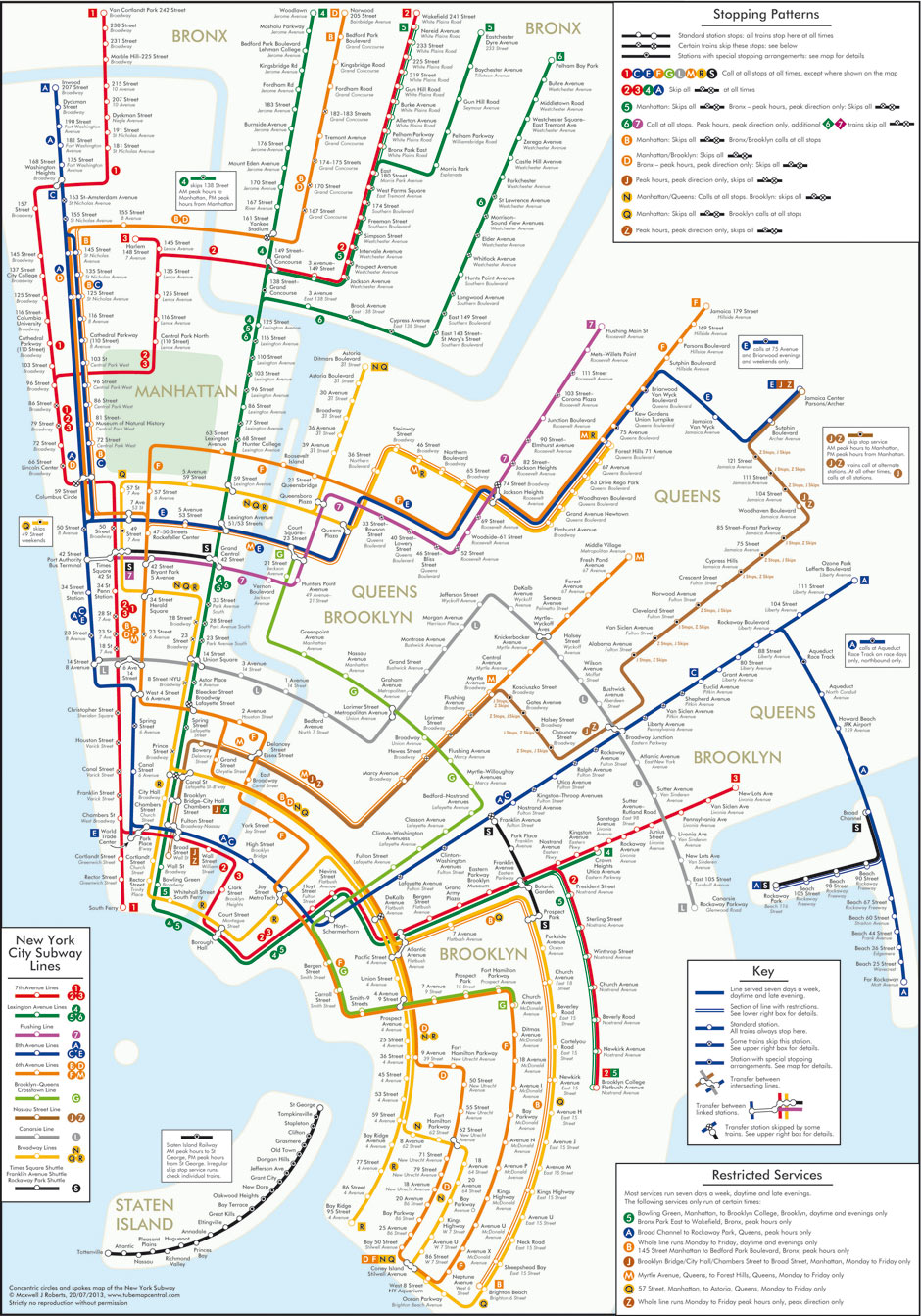
NYC Subway Circular Map – Image credit: theguardian.com
Reference: londonist.com; privatewww.essex.ac.uk/~mjr/
